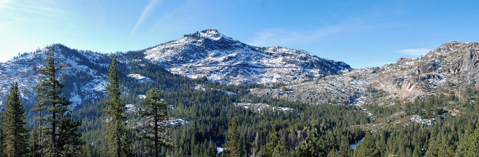
Historic Sites around Donner Summit
Donner Summit is steeped in history: Native Americans, early explorers, emigrant trails, Gold Rush towns, transcontinental railroad, early airplane flights. We've picked out the best here.
So much fascinating history is found in the Donner Summit area that we have devoted three other pages to specific topics:
- Emigrant Trails - the first emigrants to cross Donner Pass, Donner Party history, where you can view the trails today.
- Transcontinental Railroad - a brief history of the transcontinental railroad across Donner Summit, where to view the trains today.
- Old Highway 40 - First known as the Lincoln Highway and later Highway 40, long portions of the old roads remain today and provide a relaxed, scenic way to experience old Donner Summit.
Historic Locations West of Donner Summit
Colfax
The town of Colfax was named after then Speaker of the House, and later Vice President Schuyler Colfax (1869 to 1873). Speaker Colfax visited the town in 1865 while inspecting the construction of the Central Pacific Railroad. Besides serving as an important stop on the transcontinental railroad, Colfax was also the southern terminus of the Nevada County Narrow Gauge Railroad which ran through Grass Valley and Nevada City. Today you can see the Colfax Freight Depot and the restored Passenger Depot.
Dutch Flat
Dutch Flat was founded in the spring of 1851 by Joseph and Charles Dornback. From 1854 to 1882 Dutch Flat was noted for its rich hydraulic mines. In 1860 it had the largest voting population in Placer County, Chinese inhabitants numbered about 2,000. Here Theodore Judah and D. W. Strong made the original subscription to build the first transcontinental railroad. The historical marker is located on the northeast corner of Main and Stockton streets.
Iowa Hill
Gold was discovered in Iowa Hill in 1853, and by 1856 weekly production was estimated at one hundred thousand dollars. The total value of gold produced up to 1880 is placed at twenty million dollars. The town was destroyed by fire in 1857 and again in 1862, each time it was rebuilt with more substantial buildings, but the last big fire, in 1922, destroyed most of the town. The historical marker is located 0.1 mi southwest of the post office on Iowa Hill Road.
Alta
In 1911 pioneer aviator Robert G. Fowler crashed in his Wright Model B biplane near the town of Alta. Fowler was attempting to make the first transcontinental flight. As he approached Alta, mechanical trouble forced the plane toward the ground.
Seeing mostly trees below, Fowler steered to the only possible landing spot, a ridge near the railroad tracks. He attempted to guide the plane between two trees, but its wing clipped a tree and the aircraft dropped 50 feet to the ground, the shock of the fall lessened by intervening tree limbs. Fowler survived, his plane was repaired in Colfax where a monument to him now stands, and he set off again. The flight was completed on February 8, 1912.
Gold Run
Gold Run was originally called Mountain Springs. The town was founded in 1854 by O. W. Hollenbeck. It was famed for its hydraulic mines, which from 1865 to 1878 shipped $6,125,000 in gold. Five water ditches passed through the town to serve the mining companies, but they had to cease operations in 1882 when a court decision made hydraulic mining unprofitable. The historical marker is located on the southwest corner of I-80 and Magra Road, across the street from post office.
Omega Overlook
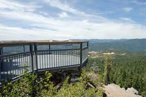
From the overlook at the rest stop along Highway 20 you can look down on the Alpha and Omega Diggin's. The scars from hydraulic mining there are clearly visible. Water from the Yuba River was diverted to the mines through the Omega Ditch and through wooden flumes suspended from the granite cliffs above the river.
Grouse Ridge Lookout
Restoration of the 1923 Grouse Ridge Lookout is in progress. The lookout stands at 7,712 feet atop Grouse Ridge, about 7 miles out Grouse Ridge Road off Bowman Lake Road. When completed the lookout will be available to rent for overnight stays. However, apparently the project has stalled.
Historic Sites at the top of Donner Summit
Donner Summit Historical Society
The Donner Summit Historical Society maintains a small museum and office in Soda Springs. Over the years, in partnership with others, they have established a series of roadside signs along the old Highway 40 route, providing the history and early photographs of each location. Donner Summit Historical Society
Hutchinson Lodge
This old stone ski lodge was constructed by the Hutchinson brothers in the mid-1920s for their Sierra Ski Club. Today it is part of the Sierra Club's series of mountain lodges and huts. Nearby is the Clair Tappaan Lodge, constructed in 1935.
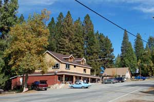
Sugar Bowl
Established in 1939, Sugar Bowl was the first real ski resort built in California. Visitors often came by train, disembarking at the Norden Station a couple of miles down the road. The original lodge is still in use today.
Beacon Hill
Beacon Hill at the summit of Donner Pass was used for an early signal station to guide aircraft in their transcontinental flights.
Historic Sites East of Donner Summit
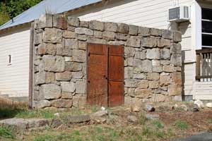
Truckee
Truckee's historic district has many homes and buildings erected in the 19th and early 20th centuries. Among the places to visit are the Truckee Hotel, the Schaffer House, Gray's Log Waystation (1863), the Chinese Herb Shop, the train depot, and the stone garage. Walking Map of Downtown Truckee
Rocking Stone
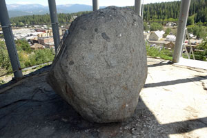
The 17-ton Rocking Stone rests atop another huge granite boulder in Truckee. Until recently the top stone would rock at the touch of a finger. Now it has been cemented in place. An alter like structure was built around it. The site has been used for various activities over the years. The building next to the stone and the site itself are now owned by the Truckee-Donner Recreation and Park District.
Boca Townsite
The Boca Townsite Trail located east of Truckee recreates images of the historic
town of Boca first built as a construction camp for the Central Pacific Railroad and
later provided ice and timber for the Boca Mill and Ice Company.
Boca Townsite Trail
Historic Sites along Foresthill Divide
Foresthill
Originally known as Forest Hill, the town was founded during the Gold Rush. You can pick up a walking tour guide from the Foresthill Divide Museum on Harrison Street or from many local businesses. A walk through the Old Catholic Cemetery east of town gives you a sense of the people who once lived in Forest Hill.
Forks House Plantation
Eleven miles east of Foresthill stood the Forks House, a 19th century hotel. Nearby at the plantation began some of the earliest efforts by foresters at replanting areas devastated by fires. Among the trees planted were Giant Sequoias, some of them now a century old.
Westville
Fifteen miles east of Foresthill the Westville Hotel stood for years, serving visitors traveling into the high mountains. Today only a few remains of the hotel's foundation can be found on the far side of a pond there.
Mumford Cabin
About 3 miles from Westville and down along the American River, early miner John Mumford build a small log cabin which still stands today.