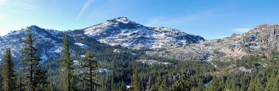
Truckee-Donner Emigrant Trail
Stephens-Townsend-Murphy Party, 1844
The Truckee-Donner Emigrant Trail was opened by the Stephens-Townsend-Murphy Party in 1844. Arriving at Donner Lake in late November, they decided to leave six of their eleven wagons behind in order to ease the difficulties of crossing Donner Pass.
Eighteen-year-old Moses Schallenberger and two others agreed to stay behind and watch over the wagons. The emigrants had to dismantle their wagons and haul them piece by piece up the granite sides of Donner Pass. They continued down the western side to Big Bend. Schallenberger's two companions succeeded in making the crossing shortly afterward, but he was too weak and remained behind, nearly starving to death before he was rescued in March.
The Varied Routes of the Trail
Soon after the first crossing of Donner Pass, emigrants sought an easier route to the south, heading up Coldstream Canyon south of Donner Lake. From the head of the canyon they crossed at Roller Pass between Mount Judah and Lincoln Peak. Others contend that some emigrants crossed farther to the north between Mount Judah and Donner Peak.
To learn more about emigrant trails in California and across the country, see the Oregon-California Trails Association.
Where to Find the Emigrant Trail
Commemorative Overland Emigrant Trail
Stampede Reservoir to Alder Creek
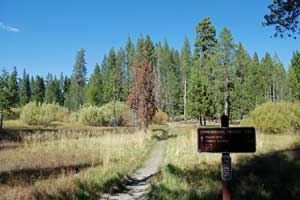
Although not on the exact route of the Truckee-Donner Emigrant Trail, the 13-mile Commemorative Overland Emigrant Trail is close enough that it gives visitors a good sense of the emigrant experience from Stampede Reservoir to beyond the Donner Camp on Alder Creek.
For a map of the trail more details about hiking the route, see our Day Hiking page: Commemorative Overland Emigrant Trail.
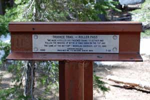
Trail Marker on Roller Pass
Coldstream Canyon and
Roller Pass
A 6.5-mile stretch of the emigrant trail from Donner Memorial State Park to Roller Pass makes a good day hike. The first 4 mile of the trail are fairly easy with only a slight grade. Soon after crossing the railroad tracks at Horseshoe Bend, the trail begins to climb more steeply, all the way to 7,900-foot Roller Pass.
The final pitch to the top of the pass was so steep that ropes or chains were run from the wagons, up over rolling logs on the top of the pass and then to the teams of oxen just beyond the summit.
Roller Pass can also be reached by hiking a little over 2 miles south on the Pacific Crest Trail from the trailhead at Donner Pass (old Highway 40).
Kidd Lakes section of the Emigrant Trail
The trail follows almost exactly Kidd Lakes Road from where it leaves Soda Springs Road west to Kidd Lake, a little more than 3 miles.
Emigrant Gap
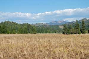
Bear Valley
A historical marker is posted at the spot where the emigrant trail passes through Emigrant Gap before descending to Bear Valley (shown right) along Highway 20. There the trail split, the 1850 Nevada City Trail (see below) leading along today's Highway 20 route and the main Truckee-Donner Trail continuing along Lowell Hill Ridge on a route 1.5 miles north of - and paralleling - Interstate 80.
Steephollow
A few miles northeast of today's Rollins Reservoir the trail made a sharp descent to Steephollow Crossing and then continued west along the north side of the reservoir. The trail crosses Highway 174 in the Chicago Park area, north of Colfax. Several markers along Highway 174 indicate the route.
The Donner Party
Slowed by taking a supposed short cut from Utah into Nevada, the 1846 Donner Party didn't reach the eastern foot of the Sierra until late in the season with snow already falling in the mountains. The party decided to spend the winter near Donner Lake. The Donner family, which had fallen behind, chose to winter at Alder Creek, near today's Prosser Creek Reservoir.
Short on provisions and unsuccessful at hunting, the party starved during the winter. Stories of cannibalism at the camps are well known. A group of 15 eventually made it across Donner Pass in the snow on foot, but it wasn't until March before relief parties reached the stranded emigrants.
Shop Amazon:
Donner Party History
Donner Party History
Donner Party Sites
Donner Memorial State Park
Emigrant Trail Museum
The Emigrant Trail Museum is located at Donner Memorial State Park.
It depicts the history of the area and the people who came into this part of the Sierra, including local Native Americans, the Donner Party, and builders of the transcontinental railroad. Postcards, posters, maps, and books about the human and natural history of the area are for sale at the museum.
Pioneer Monument
Near the museum is the Pioneer Monument. and the Donner Party's Murphy family cabin site. There you will find a large stone against the Murphy family's 1846 cabins was erected. That rock contains a plaque with the names of all of the Donner Party members.
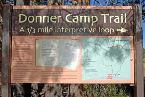
Donner Camp
The Donner Camp on Alder Creek can be found along Highway 89, three miles north of Truckee. Four picnic sites, restroom, interpretive trail explains the 1846 George Donner family camp. The site also serves as an access point for the Commemorative Emigrant Trail.
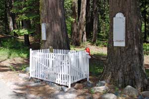
Donner Cross - Graves Cabin
A 16-foot wooden cross erected in 1887 once marked the site of Graves-Reed family cabin. Over the years the cross rotted out and was replaced several times. Eventually the location was taken over for use as an agriculture inspection station. The cross was moved to a position along Donner Pass Road between Truckee Elementary School and the Citizens Bank Plaza.
The Nevada City Trail
The Nevada City Trail was established in 1850 as a cut-off to Nevada City from the main Truckee-Donner Trail. The Nevada City Trail closely follows Highway 20. Today's Pioneer Trail traces nearly the exact route of the original emigrant route. A map of the Pioneer Trail can be found on our Horseback Riding page
Lone Grave
Lone Grave is located along the side of Highway 20 about 7 miles east of Nevada City. The burial site is that of two-year-old Julius Albert Apperson who died in 1858. The Appersons were early settlers in the area. Volunteers have cared for the grave as a memorial to the many pioneers who lie buried in solitary, unmarked graves in California.