The Earliest Roads over Donner Summit
In 1863 as plans for building a railroad over Donner Summit developed, the Dutch Flat and Donner Lake Wagon Road was constructed to serve as toll road for travelers headed to the Nevada mines and a supply route for the railroad workers. With a crew of several hundred men working steadily, the road opened in 1864, following much the same route as the early emigrant trail.
During the construction of the Transcontinental Railroad, the road was used to haul supplies and construction material up the pass. In 1866 four locomotives were brought over the road to Truckee.
In 1901 the first automobile passed over Donner Summit on the old wagon road. The road passed through several names in the early 19th century before becoming part of the Lincoln Highway.
You can still see parts of the old road on the east side of the pass. For a detailed description of the route of the old wagon road, see
The Historic Donner Trail Committee.
Old Highway 40 over Donner Summit
The Lincoln Highway
The Lincoln Highway, dedicated in 1913, was the first automobile road to span the width of the United States. The road incorporated many existed roads into its system, including the Dutch Flat and Donner Lake Wagon Road over Donner Summit.
Where to See the Old Lincoln Highway
Donner Lake to Donner Summit - The most interesting portion of the Lincoln Highway winds from Donner Lake up to Donner Summit. You can walk this entire route, perhaps best done from the Donner Lake end to avoid a long uphill climb on your return hike (or set up a car shuttle). Brochures with a map of the route are available from the Donner Summit Historical Society. They have an office and small museum crowded with historic photographs and other interesting items at Soda Springs. For more details of the route, visit the website mentioned above: The Historic Donner Trail Committee.
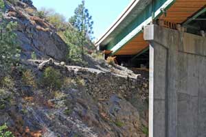
The Old Lincoln Highway Passes Under I-80
Big Bend - Much of the Lincoln Highway became Route 40, but a few sections of the old dirt road remain. One convenient place to see the old Lincoln Highway is across the road from the Ranger Station in Big Bend. The old road bed runs parallel to the paved road (old Highway 40), about 20 yards back among the trees. Markers there indicate the location.
A short distance farther west on old Highway 40 you can look across the river and see remnants of the Lincoln Highway along the hillside. Sections of original stone embankments are easy to see.
Highway 40
In 1928 the Lincoln Highway route was converted to U.S. Highway 40. Much of the original Lincoln Highway was taken by the new highway, but in a few places there were changes as improvements were made. The paved Highway 40 served as the major east - west route across the Sierra Nevada until Interstate 80 was built in 1960.
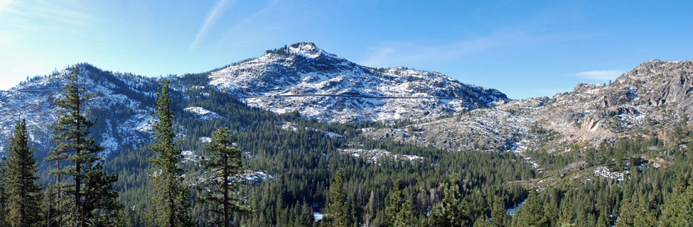
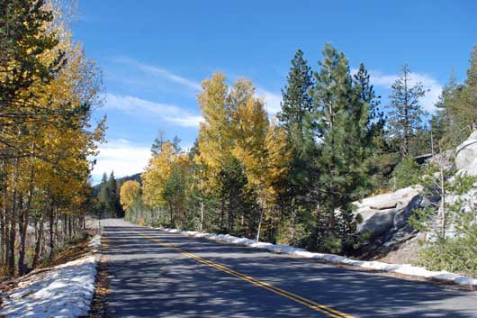
Large portions of old Highway 40 remain today and are popular with those who enjoy a more leisurely and historic drive over Donner Summit. You can drive on Highway 40 from Colfax to Baxter and then pick up Highway 40 again at Cisco Grove and follow it all the way to Truckee. The section from Donner Summit to Donner Lake across the Rainbow Bridge is considered one of the most scenic pieces of highway in the country.
The Donner Summit Historical Society's 20 Mile Museum is a series of 32 interpretive signs placed along with Highway 40 route from Nyack to the Rainbow Bridge overlooking Donner Lake. Besides providing information about various locations they have many historic photographs.
Historic Locations along Highway 40
Colfax
The town of Colfax was named after then Speaker of the House, and later Vice President Schuyler Colfax (1869 to 1873). Speaker Colfax visited the town in 1865 while inspecting the construction of the Central Pacific Railroad. Besides serving as an important stop on the transcontinental railroad, Colfax was also the southern terminus of the Nevada County Narrow Gauge Railroad which ran through Grass Valley and Nevada City. Today you can see the Colfax Freight Depot and the restored Passenger Depot.
Forest Gift Shop
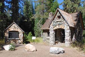
The stone buildings of the Forest Gift Shop are located on the north side of Highway 40 near Cisco Grove. They were erected in 1938 and operated for nearly a decade. The shop later was called the Sierra Gift Shop. Once the interstate was built, business dwindled and the gift shop closed.
Nearby were a gas station, grocery store, restaurant, lodge, and other buildings. Their stone foundations can still be seen on either side of the highway.
The Auburn Ski Club built a ski jump and set up rope tows here in the 1930s, one of the first alpine ski runs around Donner Summit and the first ski jump in the West.
Along the river Gould Park commemorates an early settler in the area, James Lewis Gould, who purchased the land from the Central Pacific Railroad. James was a water agent during the 1870s, connected with the Gold Run Ditch and Mining Company. He and his wife Grace lived in Dutch Flat.
The Rainbow Bridge
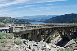
Considered one of the most beautiful bridges in California, Rainbow Bridge overlooks Donner Lake just below Donner Summit. The 240-foot bridge was completed in 1926 as part of a general upgrade of the highway leading up from Donner Lake. The concrete span is similar to others built during the 1920s, but Rainbow Bridge is unique in that it has a grade and a compound curve It wasn't until the early 1930s that the route was plowed of snow during the winter.